accurate direction-finding equipment in use today has an equipment error of plus (+) or
minus (-) 1 degree. This means that if there were no propagation errors to contend with, the
equipment itself might cause an error of over 17 miles at a distance of 1000 miles. This
problem of errors is taken up more fully in another course.
To be effective, direction finders must have access to listening posts or intercept stations,
and must be tied together with a reliable high-speed communications system, and they must
be carefully placed in well-planned locations. The spacing of these locations results in a
BASELINE, which is important in respect to direction-finding net capabilities. The listening
post will monitor several frequencies, and when a transmitter is heard, the direction finders
will be notified using the communications system. If the direction finders are placed on a
well-planned baseline they will be able to locate the transmitting antenna with a fairly high
degree of accuracy. The baseline must be arranged so that the intersection of the bearings
for a target located in the approximate center of the area of interest, will be close to 90
degree angles.
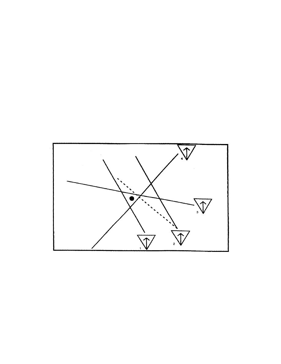
The azimuth from each direction finder is plotted on a map, the resultant enclosed area
probably includes the location of the transmitting antenna. (See Figure 1-22).
Figure 1-22. Plotted probable location.
The Chiefs of Staff of the Army and Navy have implemented a Joint Air-Sea Rescue
Communication Plan (Joint Emergency Rescue Communication Plan JANY-10) which
prescribes the procedure to be followed in establishing contact with shore DF stations. The
services maintain high frequency DF networks along the various air routes. providing aids
"fixes" to aircraft.
IT0302
1-20


 Previous Page
