Figure 2-3. Increase in Altitude.
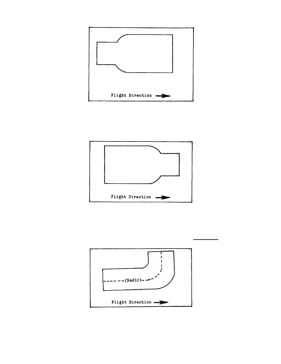
(2) A decrease in aircraft altitude will cause the sensor to cover less area on the
ground which results in a decrease in the width of your plot.
Figure 2-4. Decrease in Altitude.
b.
Aircraft Turns. An aircraft making a turn along the flight path will cause the plot to
bulge since more area is covered on one side of the flight path than the other side (Figure 2-
5). Caution must be utilized when plotting IR imagery because turns will not be obvious.
Figure 2-5. Aircraft Turn.
41
IT0654


 Previous Page
